| 2006/04/30 Back to my roots: reunited with Mammoth | |
|
π
2006-04-30 23:14
by Merlin
in Flying, Nflying, Nsnow, Snow
It might not have seemed like much but going to Mammoth again is something I had wanted to do for a long time now (7 years) because it was the very first time I had gone to a ski resort, and the first time I had flow in a small plane too.
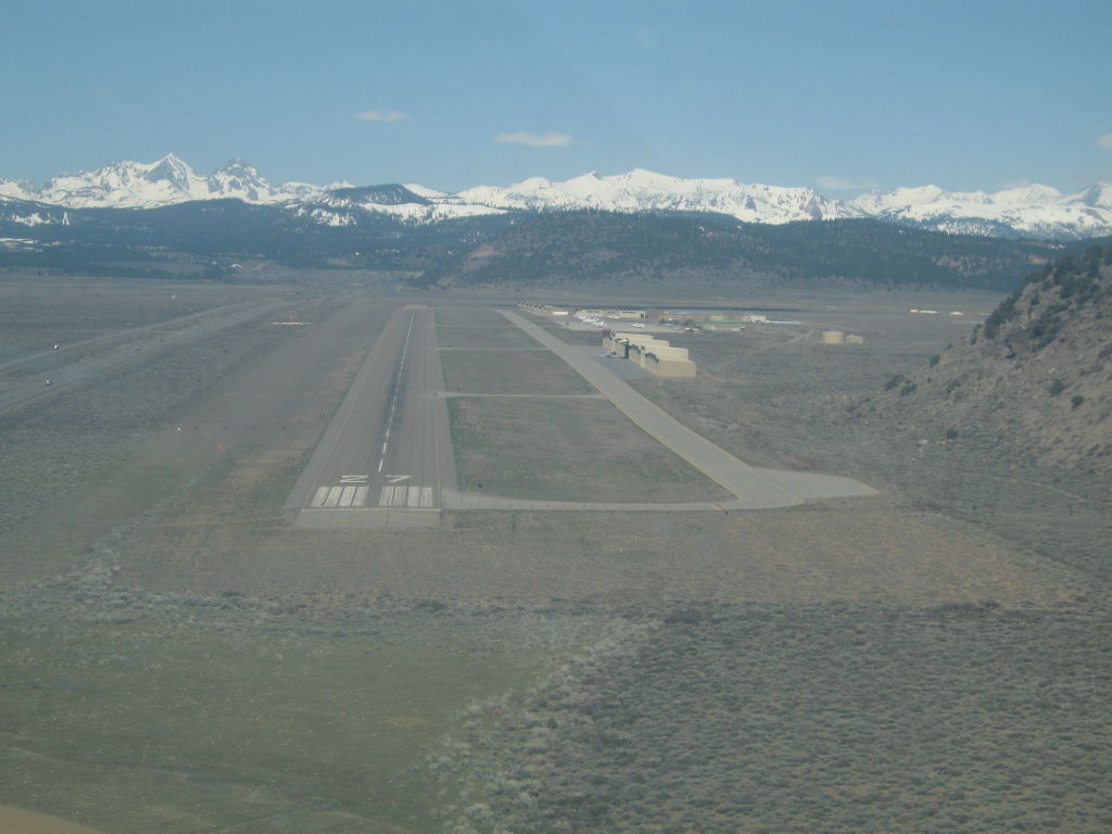
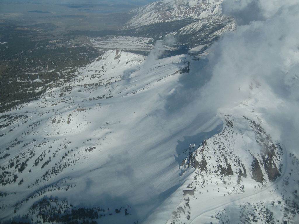
I thought both were cool, and I picked up snowboarding soon thereafter, and flyiing a few years later (better late than never ;) ) This day was my first time doing a solo flight to Mammoth and going to the resort to enjoy the snow. My last and first time there, I spent my entire day on a bunny slope, and kicked myself for it later considering how much there was to see in the mountain :) (not that I had a choice, I had no idea how to ski or board). Turns out I have some pictures from that day, and even found the exact date and ex-coworker pilot I went with back then. All the pictures from back then are here Anyway, this time it was my turn to go on my own. The flight to Mammoth was mostly uneventful, due to nice weather, and a triply redundant navigation route: VORs (Merced/El Nido/HYP, Vector 023 off Friant VOR with a shortcut by the GPS intersection CAINS), and two GPSes: the built in Apollo GX60 in the plane, and my hand held hiking Garmin Etrex Vista Cx (used for the maps shown below). My path, unbeknownst to me, actually went right over the ski slopes of Mammoth (pictures #3 and #4 below), so it was nice to get a glimpse from the sky. The landing was uneventful, except for a not very square base to final turn which overshot the runway a bit, as I had a hard time turning. It's only later that I realized that I had forgotten to turn off the quite primitive 1 axis autopilot (don't laugh, in that plane, it's not actually that obvious that it's on as opposed to just feeling some wind resistance)
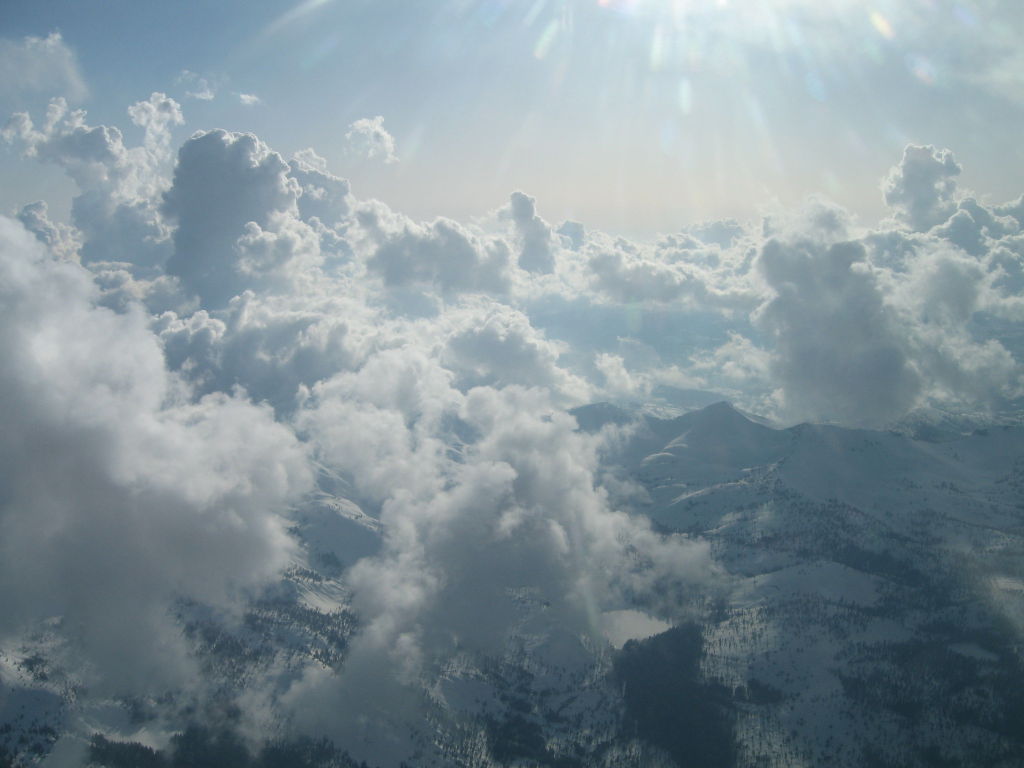
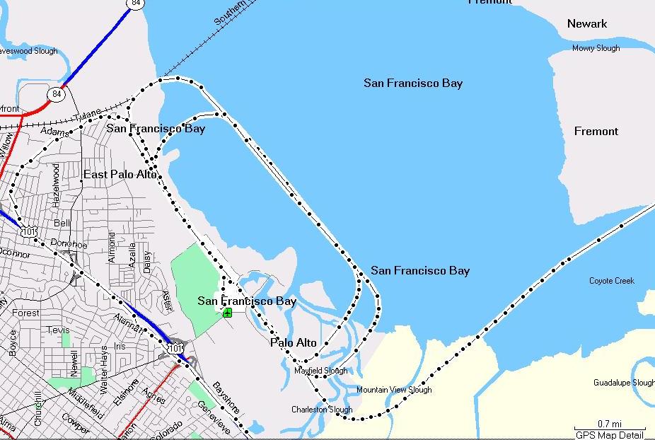
Turns out the my Etrex Vista would make quite a decent GPS for flying: it has routing capabilities, built in altimeter and compass (with magnetic and true heading) to backup the GPS data, and as a GPS (with WAAS built in), it's actually a better GPS than most GPSes in older planes. Unfortunately, according to FAA regulations, Garmin apparently cannot provide airnav maps for that GPS, so while it has most airports, it's missing all airnav GPS intersections (like CAINS here), and of course navaids like VORs (El Nido/HYP and Friant/RIU in my flight). It's kind of a shame that airnav data can't be put easily on that GPS, because in some ways, it would be a more useful GPS to use than the one in many planes (many don't even have a real/usable moving map screen), and it can be conveniently loaded with a route at home, as opposed to in flight (on the ground is hard since you may run out the battery if you haven't started the engine, and if you are running the engine, you pay $100-$150/h just to program a GPS :-/ ) Anyway, I ended up trying a route southbound from KPAO towards the SJC class charlie, and crossed over 101 going east as soon as Norcal cleared me for crossing the approach into SJC, and go eastbound towards Merced. Looking at the route logged by my GPS, it seems to confirm that going a bit too far north via Sunol pass is just easier and quicker than trying to take a short cut under Charlie to SJCC and then trying to shoot up to clear the mountains in front of you. I'll know that for next time. The flight looked like this (going there was the bottom line, and coming back was the top line).  You can notice that the top line (return trip) takes a different path than the way there because we had some very interesting clouds on the way back. They were so wild and high that I could not clear them at 14,000 feet, and barely clear them on the alternate path I took (after checking the map to make sure that I would be nowhere close to any obscured mountain top, and indeed I had at least 5000 feet clearance). I took full advantage of my allowance to fly 30mn at 14,000 feet and I'm apparently lucky to have a body that doesn't mind that altitude much, as I felt fine. My passenger however reported mild altitude sickness, but thankfully nothing serious as flying lower would have likely meant aborting the flight and going back to Mammoth. All the cloud pictures below were taken while I was at 14k feet, it was interesting to plot a course between them, as if they were high mountains. I also paid close attention to my VSI to make sure I wouldn't somehow get into a downdraft, but the air was quite smooth.
Due to where I ended up once I had cleared the clouds and the mountains, I was north enough that it made more sense to come back via Livermore and Sunol pass, so I just did that. What was a bit weird was that I was having a hard time setting the plane down at PAO: I had bounces on all 3 landings, despite an approach speed of 65knots, and wind that didn't seem gusty. The first two times, I just elected to go around and come back for another try, and was able to set the plane down the 3rd time, but I wish I knew exactly why I got those landing bounces and if I could have done something to avoid them as in more than 450 landings, I've never had this problem. I asked one of my CFIs, but didn't get anything conclusive. Oh well, a mystery for the day, and what matters is that I went through procedure and did proper go arounds when warranted.
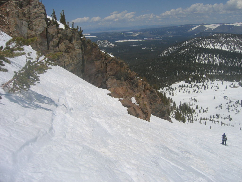
You can look at the rest of the pictures from the flight to Mammoth (KMMH) and download a mapsource compatible gdb GPS file of the flight and the snowboarding Anyway, enough about the flight, here is some info on the resort itself: Driving to Mammoth from the airport is about 15-20mn and costs around $28 each way, which is close to what you'd pay for a rental car, without the hassle of renting a car that is. The resort itself seems to have 4 different lodges that you can start from, and the peak is at 11,053 feet. While the snow wasn't too great by end of April, it still made for decent snowboarding, and even if we only had 4H of boarding before the resort closed, it was still enough to see most of it. Jen was a bit tired, but did ok considering, and it was a good day. I was keeping an eye on the clouds that were coming down as the day progressed, and even if they worried me a bit, I figured I'd find out in the air whether there would be a path home, or not, and they were, so it made for a good exercise.
You can look at the rest of the pictures from Mammoth resort |


| 2006/04/20 Passed 150 hours of flying / KLVK training | |
|
π
2006-04-20 23:01
by Merlin
in Flying, Nflying
I hadn't been flying much (make that at all) for a while since it was snowboarding season, and weather pretty much sucked every weekend (well, good for snowboarding, but bad for flying)
Today, I finally went for a practise/refresher flight and boy was I rusty... Actually my landings were pretty good, but the procedures, checklists and all were tough. If it weren't for the checklist, I would most likely have been screwed. I went to livermore (KLVK) for multiple kinds of take offs and landings in a high performance plane (172XP), and things went mostly ok, I just could tell the practise was well needed. Oh, the cool thing is that thanks to my handheld GPS, I can record the flight, and replay it later  Oh, and here are my flight stats to this day: Flight Hours: 153.4 Landings: 470 High Perf Aircraft Hours: 25.8 Complex Aircraft Hours: 8.1 Night Hours: 8.1 Night Landings: 21 |